Friday, September 28, 2012

Day 19 || Galena


Final Full Day On Savanna North Trip


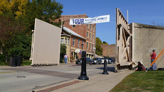
The day starts with a wake up bright and early at the crack of dawn or maybe it was seven. We load up the vans at eight and depart on the two and a half mile trip to downtown Galena. We start our tour of Galena in Grant Park and slowly make our way over the Galena River, originally named the Fever River. We take minor breaks to discuss the difference between Universal Design and the Americans with Disabilities Acts. The class picks up some images of design gone wrong for our digital graphics library.


After a lecture given by Michael and Deb, the students know more about the old town. We learn the quaint little town wasn't always so picturesque, like Chicago the small town once was destroyed by fire. The now retail oriented town was once known for it's mining and agriculture and was at the height of it's population in 1883. Although the small city lost people as time passed on the town didn't reach it's highest prosperity until the 1940s. The Galena River has always been and important source for the city, but has never truly been maintained. The city first started to dredge the river in 1839, two years after it survived it's biggest flood. The river is nearly a third of the size it originally was and in 1951 the city installed massive floodgates that will protect most of main street incase of major flooding.


The end of the lecture brings a Scavenger Hunt of sorts. The students were divided into pairs and set off to collect A section cut, a slope calculation, a sketch of something that represented the agricultural and mining past of the river, a quick study of the floodgates, a materiality study, and a quick sketch of a stone building with a date engraved.


Sketches from our scavenger hunt


After lunch we meet for our last project of the trip. We are divided into teams and given the assignment of redesigning the entire streetscape of Galena. The project is to be started in Galena and we will be following through with more specifics back in Ames. The criteria for the project is to make a threshold that references the river. We are to make a master plan of our design with two section cuts, a design program and a perspective drawing. The trip started off with a big project but ended with a bigger one. Yet we most definitely were up for the task. Some students lowered the existing street, others made new bridges to cross the river, and one group even redirected the traffic of Main street. 


The sketches above are from our initial site response and evaluation. We then spent much of the evening working away in the hotel to complete the project design and layout. Next stop....Ames! But not without a stop in Dubuque, specifically Eagle Point Park designed by Alfred Calwell. 


Thursday, September 27, 2012

Day 18 || Chicago half-day Galena Half-day

The day starts out with a great morning with a delicious but not satisfying breakfast. Everyone then collected their bags and started the short walk across Chicago traffic to the parking garage where our chariots were awaiting out departure. We ditch our luggage and then began the hike to Grant Park on the shore of Lake Michigan. Halfway there out amazing professor Micheal Martin pulled the whole group aside and talked about how Michigan Ave. used to be a lake front street. He then went into how Grant Parks foundation was established. Suet from the Chicago fire and dirt from tunnel excavation was pushed from Michigan Ave. out into Lake Michigan.

Buckingham Fountain
Our second stop was at the overwhelming and powerful Buckingham Fountain. The largest fountain in the world. After doing a little analysis of the fountain and its immediate surrounding areas we discovered that it was designed with a symmetrical design. This is a characteristic of the beaux art movement.

The BP Bridge Leading into Millennium Park
Plan View of Millennium Park
We then move our way into the dazzling Millennium Park. Over the BP Bridge, designed by Frank Gehry who also designed the Jay Pitzker Pavilion, we went to several design spaces such as Crown Fountain, Cloud Gate, and Lurie Gardens. After brief lectures of each space we were let loose to artistically express our interpretations of a single space through the medium water color.

a critique down of our watercolors
Before our departure from Chicago we were allowed an hour for our last Chicago meal on the Savanna Studio. We then gathered at the awaiting chariots again to finally leave the windy city.

Once we made it through all the construction and tollways we had a three hour drive ahead of us to Galena Illinois.

After arriving in Galena we were let loose to have the rest of the night to ourselves.
Just the Family

Wednesday, September 26, 2012

Day 17 - Conservation Design Forum

WAKEY WAKEY, put your nice clothes on, it's time to go visit the design firm. Easier said than done though. We awoke this morning to find two of the vans' spare tires had been stolen. After a half hour delay, we hit the road and drove north to Hoffman Estates. Once there, we met up with Jim Patchett, an Iowa State alumnus and founder of Conservation Design Forum (CDF) in the Chicagoland area. Conservation Design Forum (CDF) is a multidisciplinary firm that specializes in water resource management; water drives every design.

Bluff Spring Fen

We first traveled to Bluff Spring Fen, a remnant prairie full of native Illinois plant species that maintains its water runoff through underground streams and seeps. Patchett brought Savanna Studio to this prairie to show us a natural working landscape that manages its water effectively on its own. He taught us that we must understand complex systems like these in order to design landscapes that manage its own water like it does so efficiently in nature.


AMCOL Headquarters
After viewing a natural water management landscape, we went to the AMCOL Headquarters, a business campus that CDF designed with water management in mind. The campus is built with permeable sidewalks and roads and extensive drainage systems that drain into its own prairie. The drainage system restricts water from running into stormwater management systems and saves energy. Furthermore, the AMCOL Headquarters employs green roofs to reduce water runoff and reuses "gray" water in its toilets.

Jim Patchett talking about the water systems
Seeing landscape architecture, engineering, and architecture come together as one from nature to the campus was really interesting. The day truly showed us the different paths we can take in our careers and how we have to be collaborative with all design disciplines. Thank you Jim Patchett and CDF for sharing your day and extensive knowledge with us.

Brett & Austin

Tuesday, September 25, 2012

Day XVI (16) Botanic Garden and Caldwell Lily Pool

Day XVI (16) Botanic Garden and Caldwell Lily Pool

We started our morning by loading up in the vans and travelling to the Chicago Botanic Garden in Glencoe, IL. Started by John Simonds in 1972, this garden focuses on the interaction between humans and plants. The purposes of the Botanic Garden are collection, education, and research of various plant species.

Julie, Chad, and Deb brief us on our plant sketch assignment.

With the help of grad student Chad Hunter, we took a very long (but informative) plant walk through the gardens, making a 2-page  spread of the plants that we saw, while adding notes and comments.

Chad Hunter shows us the leaves of the Quercus imbricaria.


We saw a wide variety of plants including (but not limited to) coffee trees, birches, oaks, and alders.

We're all gathered around sketching and annotating the plants.


One interesting area in particular was the Esplanade Plaza.

This was the fountain in the pond of the Esplanade Plaza.


Our plant walk was long and grueling (we didn't have lunch until 3:00), but the time and effort we put in was well worth it. We all had beautiful drawings of the plants that we encountered in the garden.

An example of the two page sketch of the plants (complete with colored pencils).


After our late lunch, we all loaded back up in the vans and headed over to Lincoln Park where we visited the Caldwell Lily Pool. This pond was once murky, and weed infested, but around 2000, it was completely redone. New stonework was implemented and plants were brought in. All the plants were different ages, which prevented the site from looking completely new, but instead gave it an older feel.

A view of the Caldwell Lily Pool.


While there, we spent time making a colored pencil sketch of the pool and the surrounding plants and stones.

Some of the colored pencil sketches of the lily pool.


Monday, September 24, 2012

Day 15 Free Day Chicago

On day 15, the students had their second free day of the trip meaning that they could do whatever their little hearts desired. Most students did the touristy things like visiting the many parks downtown Chicago has to offer as well as the well-known museums. In addition to just visiting, some students felt the urge to help themselves understand their touristy destinations by quickly sketching them in their sketchbooks, which will later be graded by the professors at the end of the semester.
(Austin Javallera)
(Tim Buescher)

Some of the students got a chance to visit family in the city.  Josh Haines visited his dad and brother, skateboarded around in the city and grabbed a slice of pizza to eat at Bacci Pizzeria just a few blocks away from the Hostel Savanna students stayed in. One slice was enough to feed two people, and left everyone with a food baby.
(Josh Haines)

A group of students including Jordan G., Blake A., Amanda H., Jim D., Eric C., Chad E., Amy L., Chris H., Morgan H., went to China Town to mingle amongst the sordid masses. What a great way to spend a day immersed in another culture.


Sunday, September 23, 2012

Day 14: Ice Cream and Mis-adventures

The day started with a chilly dampness at Devil's Lake. Thankfully though, it wasn't quite as cold as boundary waters and there was no rain like yesterday. We quickly broke camp and packed up the vans, eager for the heated interiors. Everyone felt excited but a little bit disappointed, because we had to leave Devil's Lake, leave the nature morning call from the birds, and leave the marvelous nature phenomenon, but we were also excited for our final destination Chicago.

We made a quick stop for gas and lunch and then made out first real stop of the day at Prairie Crossing. To everyone's surprise we got a pop quiz when we arrived at Prairie Crossing.  The quiz was just a few questions about the reading.  We were trying very hard to remember all the details from the assigned article.  Taking notes is really important.  This housing area was built with the idea of connecting a residential setting with land ethics.  It is a prime example of a T.O.D. or transit-oriented development.  What I mean is this development has a public train which travels into the city of Chicago.  Because of that fact, the need for a vehicle (or frequent vehicle use) is lessened by quite a bit.

We also learned about the water system in Prairie Crossing.  A barrel system to collect rain is used and put to use watering gardens and lawns.  They also have implemented some thing called a rain garden, which is also known in the landscape architecture community as a storm water catchment system.  How this is accomplished is an area is dug out and sometimes lined with clay.  Then the ditch is layered in sand and gravel.  The garden planted on top consists of hydric plants (think plants you'd find in a marshy area).  This gathers the water up and plants store it for quite a time.

A gazebo in the central area among houses

Overlooking Lake Aldo Leopald

Something people don't realize a lot of the time is that letting water flow directly into the open is not a good thing of the environment.  We did an exercise while at Prairie Crossing about learning where your water travels.  We started off with a raindrop at our house and had to figure out how it would travel in order to make its way down the Mississippi to the Gulf of Mexico.  On the way, water picks up oils and chemicals which is then dumped into the ocean.  Over time this has created a space in the gulf called the hypoxic zone, also known as the dead zone.  In this area the algae has taken over so much that nothing else can survive here.  This is due to the amounts of nitrogen pumped into the area, which covers nearly 8000 square miles.

After that somewhat of a Debby downer of a lesson, (sorry Deb, I know you don't like that phrase) we packed ourselves into the vans once more, ready to get to the place we were staying.  But first, a trip to the ice cream shop to celebrate Amy's birthday.  We had a somewhat mis-adventure in getting to Chicago, though we did get there eventually.  Our vans were separated multiple times, and by the end we had switched leaders several times as well.  We also couldn't figure out where we were supposed to park, so we ended up circling downtown Chicago for about 20 minutes.  But, no harm no foul, and we got there safely in the end.
Once we had dropped off our things and all cycled through the showers we set off for pizza.  The night ended with some people visiting Millennium Park and some of us chilling at the hostel.

The wienermobile.  A rare find on our way to Chicago.

These are your bloggers for the day, Amy and Nanqi, signing off.  I also want to give a shout out to Kyle for helping out with the pictures for this post.

And as Nanqi wants me to say: 祝你生日快乐艾米

Saturday, September 22, 2012

Day 13: A Shiver in Devil's Lake/ Where's Aldo?


It was a dark and stormy night... Literally. Tents were flooded. It was in-tents... On the bright side, at least, in the morning we all were afforded an extra hour or two of sleep due to the loss that the downpour had caused. Although many of us woke up damp, our spirits were not so! We forged on to the first activity of the day, The Aldo Leopold Legacy Center.
In front of the Aldo Leopold Legacy Center.
 Here we had our first plant test on the road, which unanimously proved easier than the previous two we took this semester. Our conclusion was that we all are having an easier time getting a grip on Latin as a class. After the quiz we all positioned ourselves for the two short videos that were shown; the first covering Aldo Leopold's mission and his life, and the second explaining the Aldo Leopold Foundation. We then ventured back to the vans. After a short ride we found ourselves at the famous Aldo Leopold Shack. The shack was purchased in 1935 by Aldo Leopold, a well noted conservationist, writer, philosopher, and outdoor enthusiast. The shack was originally an abandoned chicken coop, surrounded by scarce vegetation. Within the first year there Leopold and his family began their transformation of the grounds by planting around 3,000 native plants. Over the next several decades the family continued to restore the land and live by his philosophy of living in harmony with the land. This experience was special for all of us after acquainting ourselves with Leopold's writings in his book, A Sand County Almanac.
Aldo Leopold's family shack.
We're improving our quick sketch techniques!
Outside the dwelling we were able to gather and read aloud from the book, learn more about the site and the man who built it, and reflect and discuss our opinions. After completing a short, ten minute sketch, we all did a lay down, critiqued, and left. We returned to the campsite for lunch and prepared for our hike on Devil's Lake.
Afternoon view of Devil's Lake.
     That afternoon we went on a hike on the Eastern side of Devil's Lake. The hike was beautiful and exhibited special features such as Balance Rock and Devil's Doorway, both of which rested on steep, rocky, cliff faces. This made the assigned water color at Devil's Doorway a wee bit more adventurous.

Some of us had more precarious places to paint than others, but we all made it back to camp!
After a lay down and critique we turned around and headed back to the campsite. We returned around six and finished the day with dinner, s'mores, and stories by the campfire. What a great way to end our last night of camping! That night we all fell asleep abuzz with excitement and filled with dreams of Chicago style deep dish. YUM!

Friday, September 21, 2012

On the Road to Dawakahchargra 09/21/12

Waking up in Duluth for the last time we were all excited to have a nice hot breakfast. Thanks to Julie for standing up for her students. We were joined by Mindy Cooper, who once again had a tasteful treat of Chips Ahoy for us to enjoy on the long van ride ahead. Thanks Mindy!

The convoy departed shortly after breakfast with some of us looking forward to the six hour van ride. Upon arrival we were eager to set up camp and start exploring the beautiful scenery. Before we went on a walk Michael Martin filled us in on some history of the park. Devil's Lake State Park is located in the Baraboo Mountains in Wisconsin. The Baraboo Mountains once were taller than the Rocky Mountains are today but have became smaller over time due to erosion. Devil's Lake which is located in between the mountains was beautiful as well. It was created by two moraines that made it an Endorheic lake, which means that it does not have a drainage system. The name of the lake was first established by the Native American Ho-Chunk Tribe. They heard voices and spirits coming from the lake so they named it Dawakahchargra, which was translated to Spirit Lake. When white settlers arrived they renamed it Devil's Lake.
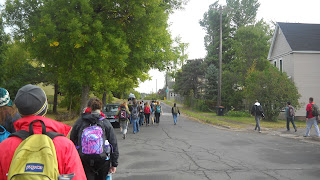
After the short lecture it was time to do some drawing.  We were to find an area where we could see the mountains in the background while having some Quartzite rock in the foreground. We had thirty minutes to complete this sketch, so we knew we could not go in to full detail.
Cormac's drawing of Devil's Lake
Michael Martin critiquing the drawings
After the critique it was getting to be supper time so we headed back to camp and started cooking. The darkness came rather quickly so we finished eating around the camp fire. After some conversing, laughing, and singing we decided it was time for bed. Although everyone separates to their sleeping quarters a little chit chat ensues but slowly dies off as the long day finally takes its toll on our bodies.

Thursday, September 20, 2012

Mapping Duluth Minnesota

Today we woke up to an extra early 6am wake up call and had a pre-day discussion with Mindy, who joined us for our stay in Duluth, before setting out to see the downtown. The start of our day was about a 4,000 foot hike (we had to calculate this later) uphill to Skyview Parkway so we could all appriate the veiw of Lake Superior and downtown Duluth. There we also got a history lesson on the city. The fun facts we learned included:

-Duluth was named for the first known European expolorer to the area: Daniel Grancelon, Sieur Du Luth
-The very first people in the area are known as The Copper People because they mined copper for tools
-Ojibwi tribe called Duluth Onigamiinsing or Place by the pongunt lake, because the lake smelled from algea difting in.
-In 1883 Duluth had more millionairies per captiata than anyother place in the world, because of shipping
-Lake Superior is 1300ft deep, but 602ft above sea level.

After our little history lesson we went down the hill, mapping out our paces so we could calculate the slope grade later, and headed into Canal Park.

Here the instructors gave us our three projects for this afternoon and freed us for lunch and work. Our projects were:

-Draw the Aerial Lift Bridge in Ink
-Do a Plan view of Canal Park
-Do a section sketch from Skyview Parkway to the lake

Starting our day with a hike up the hil 

View of Lake Superior from top of hill 

 Molded brick wall along Canal Park Drive

Touring Canal Park 

Interacting with fountain at Canal Park

After the laydowns we celebrated Jim's birthday and scattered for supper and plant studying!

Wednesday, September 19, 2012

En Route to Duluth (9/19)

We got up bright and early this morning and experienced our last taste of Ely in the form of a wonderful breakfast next door from the bunkhouse.  We filled up on pancakes, eggs, and bacon, and went on our way to Duluth.

On the road we quickly moved away from the wilderness of the BWCAW into the logged and milled Iron Range.  On the side of the road we passed many open pit mines and empty patches of forest.  This new dose of reality came as somewhat of a shock, seeing as we had just emerged from one of the most pristine wilderness areas in the country.  I think that looking back on this experience, we will come to appreciate the natural world and know our full effect on the landscape around us.

Splitrock Lighthouse
Our first stop was at the Splitrock Lighthouse on Lake Superior.  After a quick lesson on the sugar maple, we spent an hour on pencil drawings of the lighthouse, and for the first time on Savanna we were invited to incorporate one color.  For a few of us this was no problem, but a lot of us were unsure how to get started and incorporate the color appropriately.  But most of us were able to produce a drawing we were satisfied with, and learning some new techniques.
Chris's pencil drawing of Splitrock Lighthouse
Two Harbors, MN
Continuing on, we stopped for lunch and a lesson at Two Harbors, Minnesota (named for Agate Bay and Burlington Bay).  We learned of the town's importance in the iron ore industry, being an important harbor in bringing the Iron Range's minerals to the coast by rail and making it accessible to the rest of the world through the great lakes.  We saw a beginning of an attempt to create a post-industrial landscape that nods at the town's past while creating a new character.  We then moved down to the waterfront to do another pencil drawing, this time incorporating two complementary colors.  It was at this moment that the sky decided to open and downpour on us, and for us who weren't under cover, completing the drawing was... a challenge.  Some of us, however, were very successful.

Blake's pencil drawing of the dock and Edna G at Two Harbors, MN.
The day finished at the Holiday Inn & Suites in Duluth, where we met our friendly advisor Mindy Cooper.  We got to our rooms and got a good night's rest.

Tuesday, September 18, 2012

Captain Chief President Chairman Doug Johnston Sir's Boundary Waters Group!

We woke up early early Saturday morning shivering and speedily consuming our breakfasts, some of us turning our plate of eggs, pancake, and bacon into a sloppy, sticky, taco mess.  After a brief lesson on paddling we hopped into the canoes and we were off! The first portage was an intimidating 140 rods and very hilly and rocky. The rest afterwards were much shorter, however our journey went on for quite a long time. After about four hours of paddling and lugging our fat packs through portage after portage we stopped for a delicious lunch of peanut butter and jelly sandwiches. After the first bite we knew that happiness in that moment WAS peanut butter and jelly sandwiches. After lunch we ran into a wee bit of a problem when we found that our destination of Jordan Lake was all full :( But we portaged one more time and paddled into a channel with tall rock faces on both sides. The rocks were streaked with black and orange and after some contemplation we realized that they were remnants of tribal folk paintings. Just around the bend we checked out a few sites but they were either not real sites or they all seemed to be full. Finally we spotted a large rounded smooth boulder on a point out in the distance. We canoed over quickly despite our weariness and checked out the area. It was beautiful and perfect and indeed a legitimate campsite. After scoping on the latrine ;) we settled down and cooked some delicious hot dogs for dinner. That night after we cleaned up from dinner we laid out on the rock face staring up at the extremely starry night sky. We saw an amazing amount of shooting starts, four or five in just ten minutes. But eventually we grew weary and cold and we ducked into our beds for a (hopefully) warm night in the wilderness.
FUN FACT: Our site was actually a mere four miles from Canada!

Day two, we woke up at the perfect time and ate the most wonderful breakfast, eggs, bacon, and hash browns. After a slow morning we went out in the canoes and did a mapping exercise of an island nearby. We had to canoe around the island slowly drawing the angles and proportions that we saw. When we were finished we compared them to the actual map found that they were not too shabby. Afterwards we headed to a portage nearby and did some much needed botanizing! We did a vegetation inventory, so basically mapping the plants along the path and noting the differences in plants in the higher and lower areas. Our stomaches were aching and we finally realized that it was 3 o clock so we picked up and headed back to our campsite for lunch. After lunch we worked on our Andy Goldsworthy imitation projects, which was to create a land art project. Finally it was too dark and cold to continue so we ate our beef stroganoff and headed to bed for the night.

The makings of Ian's project.

Morgan's project.

Ian's vegetation inventory.

The faded paintings.


Early on the third day we awoke to a frigid morning, and a scrumptious breakfast or french toast. With storm clouds on the horizon and a desire to put away the equipment dry, we broke camp and began our trip to Deception lake. On the way back we met up with Julie's group at a nearby portage. That night Catherine cooked us some Mac and Cheese while the rest of us worked on our water colors; thanks Catherine! Then we prepared ourselves for the fourth day's trip out. On the morning of the fourth day, we wrote one last reflection and made our last attempts at a watercolor. Afterwards, we set out for Snowbank and a ride to a hot shower.

Ian's watercolor.

Morgan's watercolor.


P.S. BIG thanks to Doug for preparing the majority of our meals (and everything else)!

-- Morgan Harty & Ian Clark